D Day Map Room
Posted: Mon Sep 23, 2013 7:39 pm
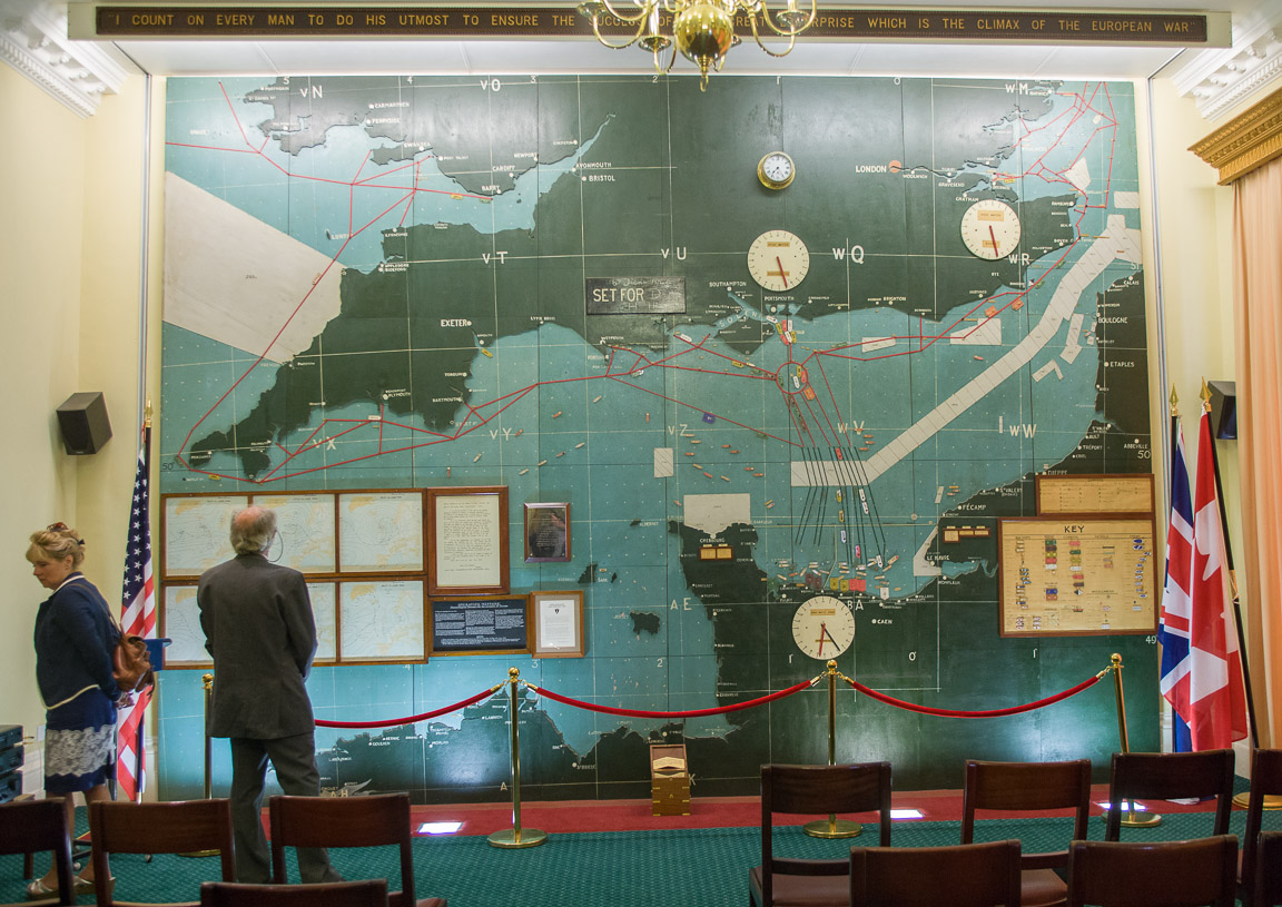
I managed to wangle a visit to the 'Map Room' on the weekend - the nerve center of the entire D-Day operation and the headquarters of Ramsay, Eisenhower and Montgomery in the months leading up to the operation. From here Eisenhower left the room to smoke a cigarette and ponder, before returning to say "OK, we'll go.”
The map is a wooden cut-out that was made by a toy maker. To ensure secrecy the commission was to make a map of the entire UK, plus France, Belgium, Spain and the rest of continental Europe. When they delivered it they were asked to assemble the South coast channel portion and bin the rest. Since they then 'knew too much' the delivery men were incarcerated until the operation was complete – a period of some weeks.
The white areas with stripes are German minefields, and plain white ones are British fields (some left from pre-Dunkerque times). The red circle is the assembly point where vessels rallied, and where those that has already left before the June 5th cancellation spent an uncomfortable night. The minutiae of preparations was illustrated by a copy of a newsletter planned for circulation in the days after the landings, to keep troops informed, suppress rumour etc. It was called the 'Beach Comber'.
A gigapixel image of the map is available here.
..